Mappings
 When I was a kid I decorated one entire wall of my bedroom with one huge map. Floor to ceiling, wall to wall. I found all the topographical U.S. geological survey maps of the local area, with our house in the very center. It was beautiful. Interesting colorful patterns when viewed at a distance, and fascinating detail up close. I was always finding some curious spot on the map that would prompt an adventure to see that place in person.
I’ve often toyed with the idea of doing that again, with a wall in my home office, or maybe in tile on the floor. Rather than take on an entire wall, I thought it best to do a 16×20 section first. Something I could frame, if it turned out well.
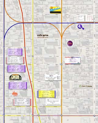
Recently I was looking at a detailed New York City map on Google. It was amazing, their graphical representations of the buildings is fantastic. This is perfect I thought. Plus, I could add collage elements of our recent visit, like theater tickets, and place them on the map right over the actual theater. Very cool. I also created a additional layer for the subway lines. These bright colored lines seem to hold the entire thing together.
Click here to see the full image. Can you imagine an entire wall done like this? I think it would be beautiful. I think if we ever moved to New York, I would have to do it.

